National Broadband Map (NBM)
NBM.RmdWhat is the National Broadband Map (NBM) data set?
License and Attribution
The license can be found here:
Broadband availability data from the BDC, and data from the U.S. Census Bureau that are presented on this site, are offered free and not subject to copyright restriction. Data and content created by government employees within the scope of their employment are not subject to domestic copyright protection under 17 U.S.C. § 105. See, e.g., U.S. Government Works.
While not required, when using in your own work content, data, documentation, code, and related materials from fcc.gov or broadbandmap.fcc.gov, we ask that you provide proper attribution of the data. Examples include:
Source data: FCC Broadband Data Collection Map layer based on FCC BDC
CostQuest Associates, Inc. and its third-party licensors, as applicable, own all right, title, and interest, including all intellectual property rights, in and to the data for locations reflected in the Fabric (including the Location ID, latitude and longitude, address, unit count, and building type code for each location in the Fabric). CostQuest is granted certain rights to Fabric correction submissions for the purpose of correcting or otherwise modifying BDC Fabric data. Broadband service providers, governmental entities, and other third parties are able to license Fabric data, including any changes to Fabric data that have been made as a result of challenges, at no cost for purposes of their participation in the FCC’s Broadband Data Collection.
A Quick Introduction
NBM was launched by the FCC in November 20221 and follows Form 477.
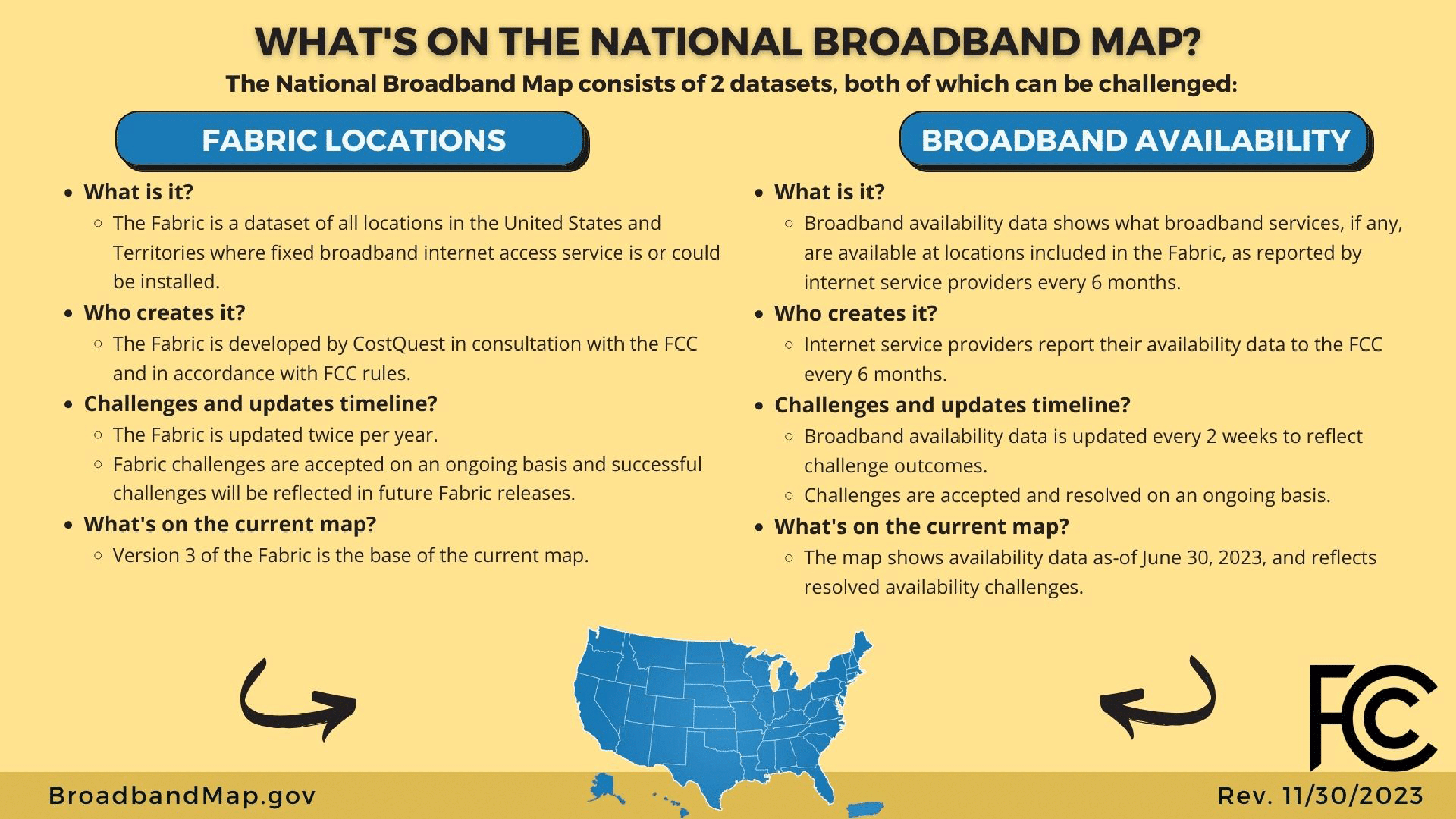
Behind the National Broadband Map, there are two datasets (see @fig-broadbanddata, below). We use the “Broadband Availability” dataset that is derived from the “Fabric” locations dataset (developed by CostQuest). The locations are determined within the Fabric locations data.
This dataset can be derived in multiple ways: by States or by Providers.
At the state level, the data can be split between summaries and “raw data”. The summaries available are by geographies or by technologies (Fixed Broadband and Mobile Broadband).
For every state, you need to access the raw data by technology. In our work, we focused on Fixed Broadband Availability data.
The NBM provides information about the scale of a “service” - a location covered by a provider and by a technology with a specific maximum speed.
This formatting approach is one of the big changes compared to Form 477. We moved from a Cesus-block scale to location-based scale (See @sec-BSL for a definition).
Every location is characterized by:
- Who is providing those services (
frn,provider_id, andbrand_name) - A description of each service (
technology,max_advertised_download_speed,max_advertised_upload_speed,low_latency) - Whether the location is residential, business or both
- Ways to localize the location (
state_abbr,block_geoid,h3_res8_id)
In our ingestion, we did not keep the h3_res8_id
property, but we added the date of the release and the timestamp
provided in the filename (see data-raw/NBM.R to get every
details).
The exact coordinates of every location is only part of the Fabric dataset. Within the Broadband Availability data, we can only link a record for a location to a Census Block (2020 vintage) or H3 hexagon.

What is a Broadband Service Location (BSL)?
A broadband serviceable location is defined as “a business or residential location in the United States at which fixed broadband Internet access service is, or can be, installed.” A residential BSL includes all residential structures, including structures that are (or contain) housing units or group quarters (as those terms are defined by the United States Census Bureau).
A business BSL includes “all non-residential (business, government, non-profit, etc.) structures that are on property without residential locations and that would expect to demand Internet access service.” (source FCC2)
When is this data updated?
NBM has two big releases per year (June and December) and have versions every two weeks to take into account challenges3. Sometimes their release can be faster (more than one per week) or slower. The FCC did not (April 2024) provide a changelog between releases or versions (but the documentation has some of the major changes4).
How does cori.data.fcc help me access NBM data?
cori.data.fcc helps you access this dataset in 3
different ways:
The package provides functions to list available data and download it
We ingested all the Fixed Broadband Availability Data and are providing it in a s3 bucket (for more performant data loading!)
We ingested all Fixed Broadband Availability data and transformed all information to be available at the Census block level.
NBM Raw Data dictionary
This dataset is called “nbm_raw” and its dictionary can be accessed
with the function get_fcc_dictionary:
table_with_options(get_fcc_dictionary("nbm_raw"))NBM Block Data Dictionary
This dataset is called “nbm_block”
table_with_options(get_fcc_dictionary("nbm_block"))